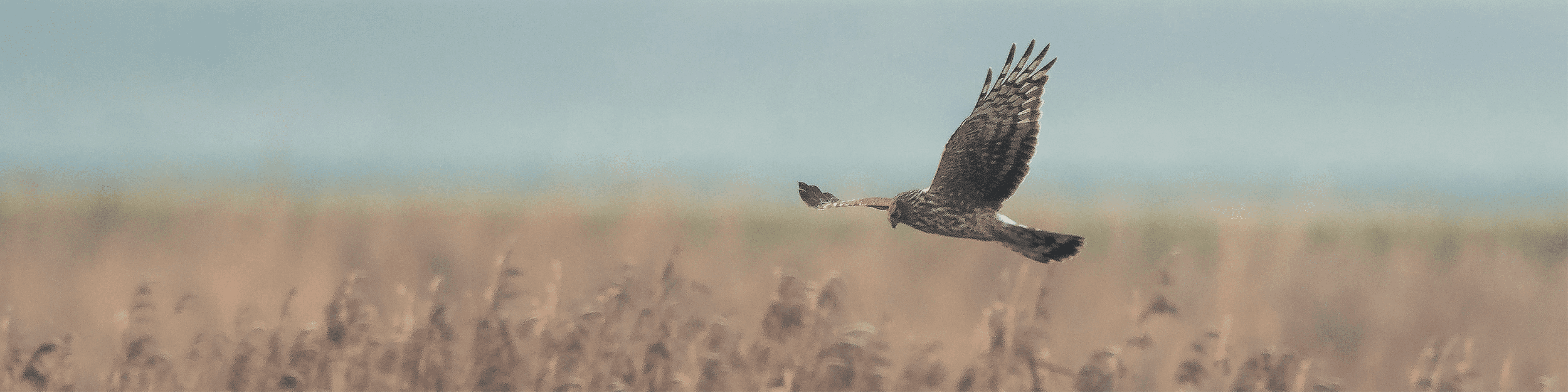
Last month, our drone and ornithology teams carried out a survey with the goal of locating roosting hen harriers at an upland site in the northwest. Surveys are carried out under licence from the NPWS and follow detailed standard operating procedures to avoid disturbance.
During the winter, hen harriers gather at roost sites at night. During the day, they disperse across the surrounding area to forage. Hen harrier roost sites can be used communally or individually, and regularly or irregularly. The number of birds occupying roost sites is variable throughout the winter, depending on weather, prey availability and disturbance. Harriers can use these locations at any time outside the breeding season, and they can be the location where they spend most of the year. Hen harriers in Ireland roost predominantly in bog areas with scattered scrub vegetation, heather-dominated bog, and overgrown rush-dominated wet pastures. Hen harrier roost surveys take place at sunset to observe birds as they arrive at the roost area. These surveys make up a significant proportion of our ornithology team’s non-breeding season survey effort in areas of habitat suitable for the hen harrier.
On the evening of the drone survey, a standard hen harrier roost survey was first carried out to assess whether the birds were present in the general vicinity of the previously identified roost area. We began with some trepidation as to whether the birds would still be in the area, as they tend to move on to their breeding ground by mid-March. Thankfully, during this survey, three harriers were observed arriving in the vicinity of the roost: an adult female and two adult males. Of these, two were driven away by a pair of very persistent hooded crows mobbing and the presence of a passing fox. A single male harrier returned a time later and finally settled out of view into deep heather as the light was fading. At this point, the general location was relayed to the drone pilot, and the drone survey began. At all times, strict protocols were followed to ensure that roosting hen harriers were not disturbed. Our surveyor-turned-spotter observed the area and, in the event any disturbance to birds was observed, the survey was to be immediately aborted.
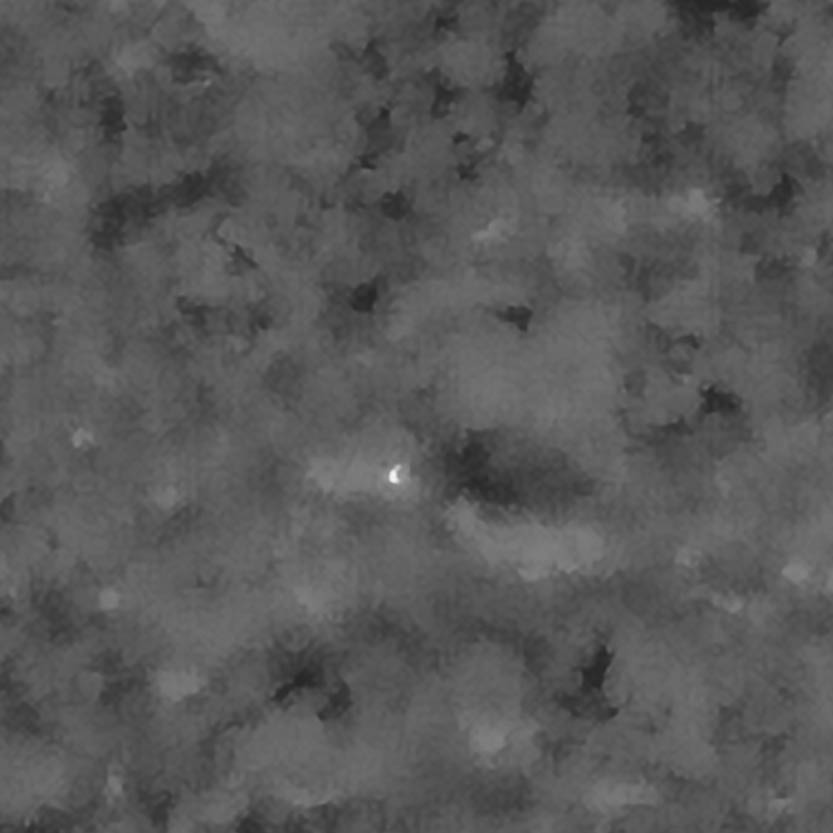
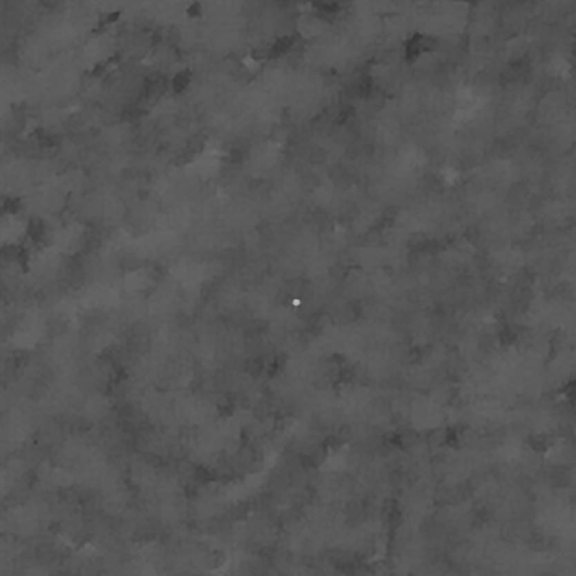
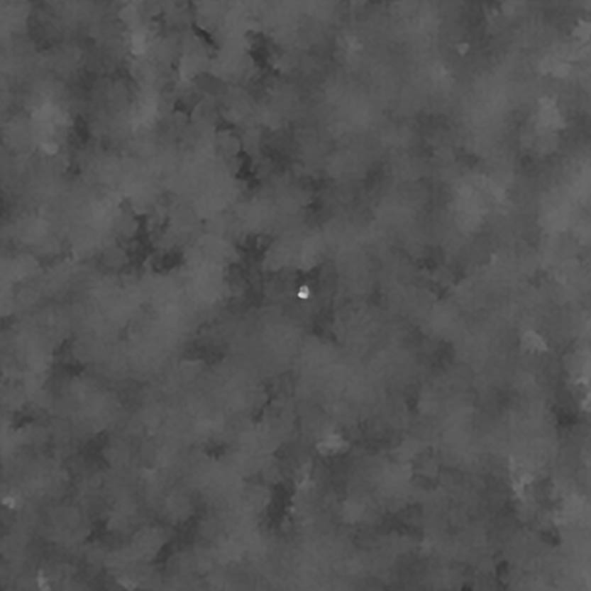
From a safe distance, the drone was launched and transects were flown in the vicinity of the roosting observation. A high-resolution thermal camera was used to identify ‘hotspots’ that were likely heat emitted by the birds. After approximately 30 minutes, we pinned the location to a centimetre-scale accuracy with a laser rangefinder. Using this method, the thermal signature of a single bird was located in the vicinity of the reported roosting bird. This confirms to us the usefulness of the drone for similar situations, whereby a bird is known to use an area, but the roost itself has yet to be pinpointed. By successfully locating this roost, the appropriate disturbance buffer can be applied to any potential development. Our drone team has successfully located breeding hen harrier nests, and we look forward to seeing where else this innovative application can be used to assist our ornithology team.
MKO’s dedicated drone survey team collects and analyses complex aerial, multispectral data to deliver easy-to-read insights and digital products. We combine cutting-edge drone technology, fully certified remote pilots and extensive experience in image processing and remote sensing to offer a wide range of services across Ireland. Managing data collection and analysis, we plan our surveys to ensure the highest efficiency and best quality. By embracing innovative tools like Artificial Intelligence (AI) and the Internet of Things (IoT), we make the real world digital and enable our clients to easily interact with it through innovative outputs: Digital Twins, maps, spatial analysis, dashboards and reports can now enhance and support every step of the decision-making process.