Our web map portal provides an intuitive, easy-to-access and complete view of results from each solar inspection. It is a web application that doesn’t require additional software and it can be shared through a web link.
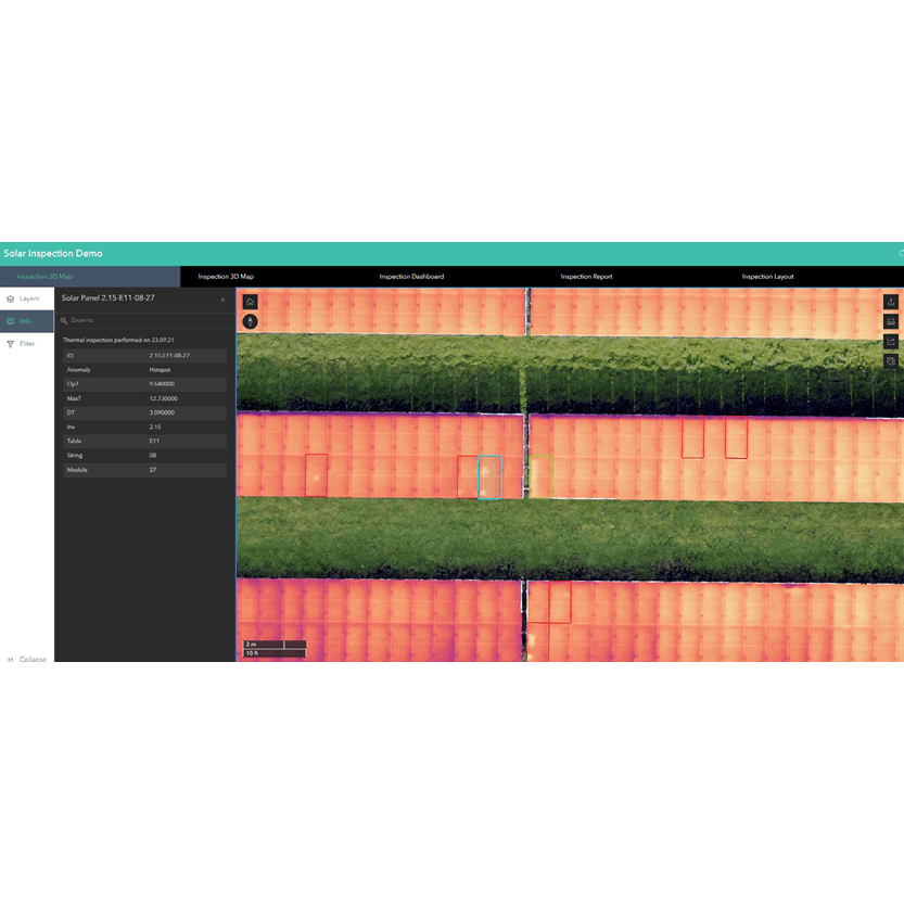
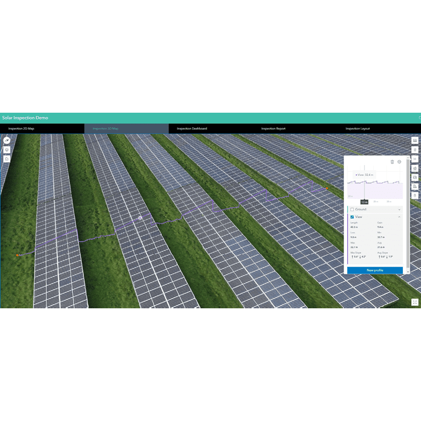
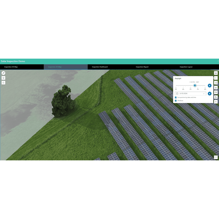
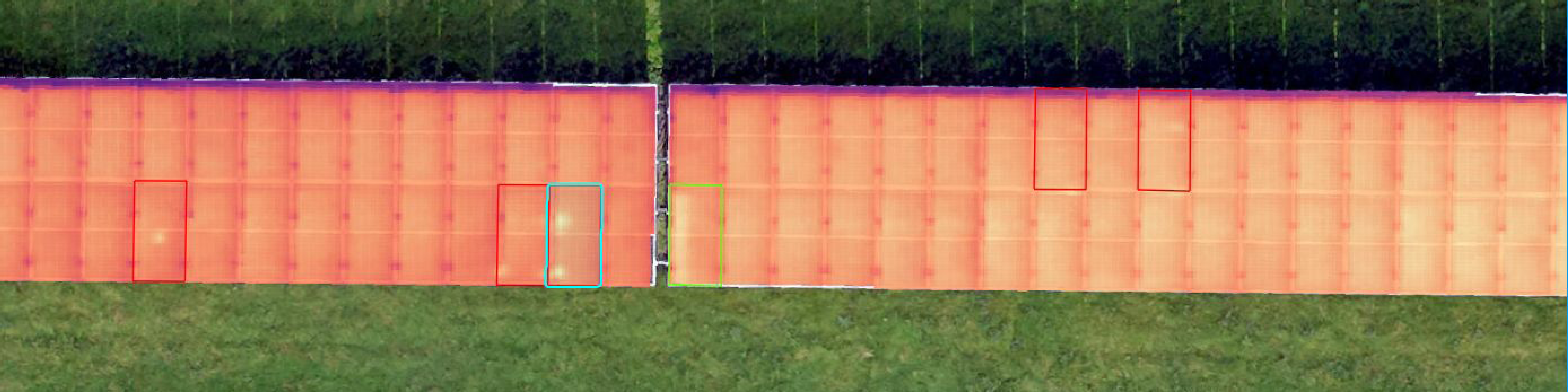
2D maps and 3D models of the solar farm are generated from the sequence of standard and thermal images captured by the drone and are available in the first two sections of the portal. Each solar panel is a digital entity by itself and can be selected to read all the related information: ID, temperature values, electrical layout, location coordinates, and possibly the anomaly identified by our remote sensing experts. Options to filter, sort and export as a table are all available. A specific colour is assigned to faulty solar panels depending on the classified issue:
- Red -> Hotspot
- Purple -> Potential Induced Degradation (PID)
- Green -> Bypass Diode
- Yellow -> Malfunctioning panel
- Blue -> Malfunctioning string of panels
The user can also interact with the 2D maps or the 3D models with multiple tools, including measurements, section profiles, and shadowing simulation.
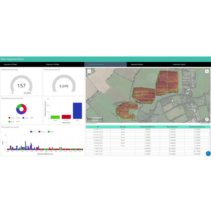
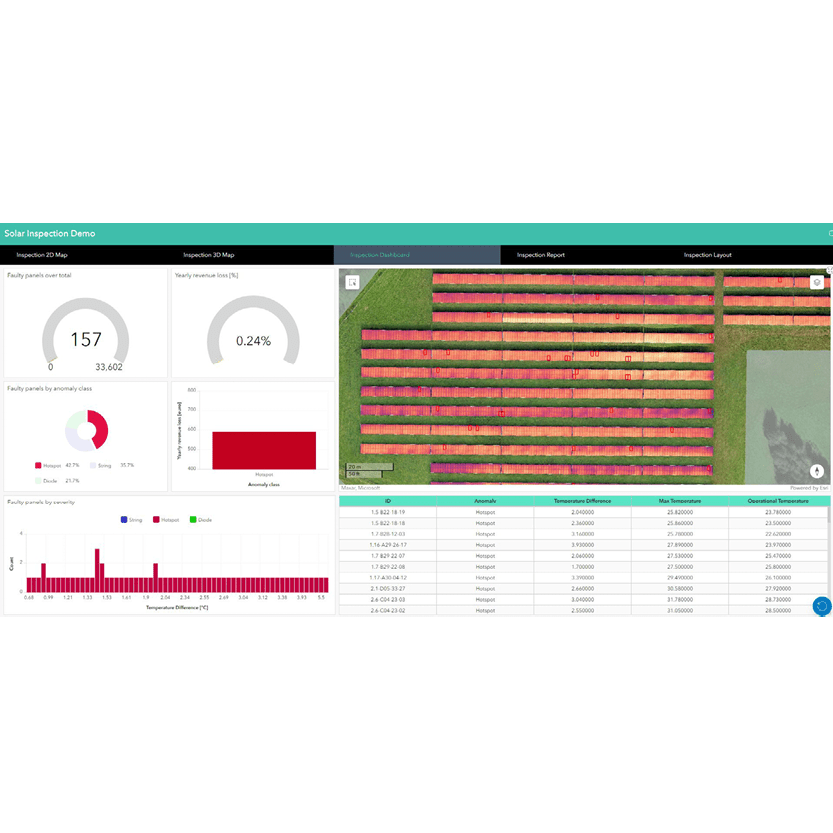
Another key section of the Web Map Portal is the Inspection Dashboard. It was designed to help the user extract insights from data and support decision-making by showing multiple analytics. It contains a list of graphs and statistics about the types and severity of the anomalies, the resulting estimated missed revenue, and much more.
Each widget is interactive by selection, filtering and sorting. The map and the whole dashboard change dynamically depending on the user, ensuring flexibility and identification of priorities.
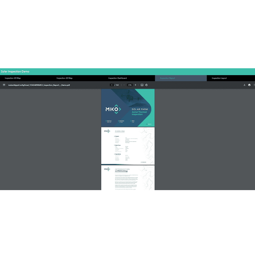
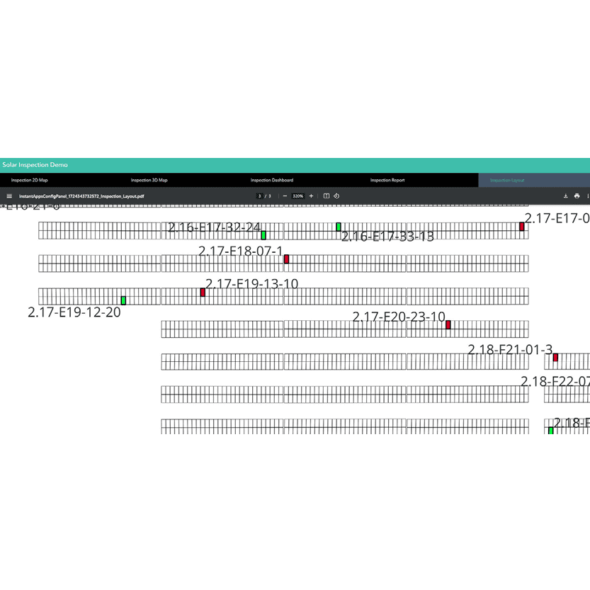
The last two sections are dedicated to reports and PDF documents. The user can open and read the Inspection Report directly from the Web Map Portal, or download it and save it for later. The Inspection Layout is generated as a drawing representing the solar farm. Multiple thematic layouts can be generated on request, colouring or labelling each solar panel depending on relevant information. Our Web Map Portal is a complete Digital Twin of the solar farm site, where insights from data collected during our drone surveys can be easily shared with many stakeholders.
If you want to hear more about Digital Twins, thermal inspections and other drone services that MKO can offer, contact us at info@mkoireland.ie